
I finally found a good map of the fires: http://media.signonsandiego.com/fires/

I’ve been a little frustrated that I can’t get a map of what is going on. I know that it has been hard for authorities to figure it out. I also know that it has been changing fast.
So far I am just happy that we are still ok. Solana Beach has been asked to evacuate, and that is a beach community not unlike ours, it just happens to be about 12 miles north of us. So, I don’t think we are totally in the clear, but I do think we are in a low probability location.
The site is a little over loaded. When I can get a good connection, I’ll take a screen shot of it.
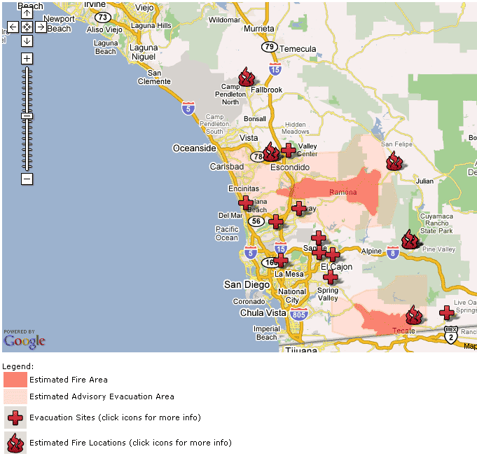
Red is the existing burn, and pink is the evacuation. The lower left of the top pink section is 8 miles from our house.
Click the thumbnail below for a larger view.
A satelite image from NOAA:
http://www.signonsandiego.com/news/metro/images/20071022noaa.html
